Empowering Informed Decision-Making through Precise Geospatial Solutions, At TerraOrbit, we are dedicated to delivering high-accuracy, reliable, and easily accessible geospatial data. Our comprehensive range of data acquisition and surveying services is designed to cater to diverse needs across various sectors, ensuring efficient planning and operations. Partner with us to unlock the full potential of geospatial intelligence.
At TerraOrbit Mapping Private Limited, we provide a comprehensive range of geospatial services tailored to meet diverse industry needs. By leveraging advanced technologies and expertise, we ensure precise, reliable, and actionable data to drive informed decision-making. Explore our services below:
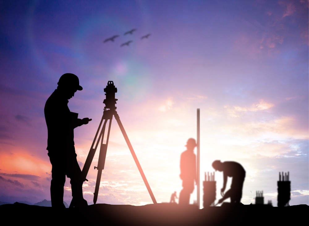
We offer precise surveying and mapping services using advanced Total Stations, DGPS, UAVs, and LiDAR systems. From topographic mapping to 3D modeling, our comprehensive solutions deliver detailed maps, engineering drawings, digital elevation models, and volumetric analysis for diverse projects.

Using advanced Total Stations, DGPS receivers, and precision levelling instruments, we conduct high-accuracy Control Network, Traverse and Ground surveys for topographic mapping, infrastructure design, and land development projects.
Process: Field data collection, coordinate adjustments, and precise calculations using geodetic principles.
Deliverables: Detailed contour maps, boundary layouts, and engineering drawings.
Leveraging fixed-wing and multi-rotor UAVs equipped with high-resolution RGB, multispectral, and thermal sensors, we deliver comprehensive aerial mapping solutions.
Process: Flight planning, aerial data acquisition, and processing through photogrammetry Tools.
Deliverables: Ortho mosaics, Digital Elevation Products, and volumetric analysis reports.
Using state-of-the-art LiDAR systems terrestrial scanners, handheld devices, and UAV-mounted units, we capture high-density point clouds for 3D modelling and analysis.
Process: LiDAR data collection, registration, classification, and processing.
Deliverables: Floor Plans, Facade Plans, 3D point clouds, classified terrain models, and feature extraction.
Our photogrammetry services transform georeferenced imagery into precise 3D models, elevation products, and orthoimages. Using advanced software, we deliver dense point clouds, accurate elevation models, and distortion-free orthoimages for applications in urban planning, construction, and environmental analysis.
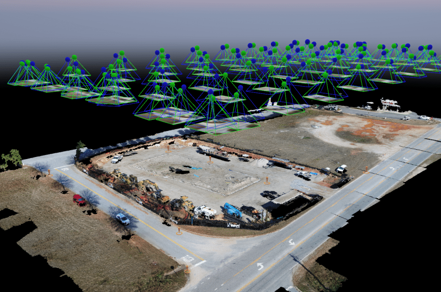
Combining advanced photogrammetric software with georeferenced imagery to ensure accuracy in aerial surveys.
Process: Image tie-points matching, bundle adjustment, IO/EO and quality control using GPS and IMU data.
Deliverables: Precisely aligned georeferenced imagery datasets.
Converting 2D images into high-accuracy 3D models for architectural, urban planning, and industrial applications.
Process: Image processing, dense point cloud generation, and 3D meshing using photogrammetry tools
Deliverables: Dense point clouds, textured 3D models, and CAD-compatible outputs.
Generating elevation models for hydrological studies, construction planning, and environmental analysis.
Process: Elevation data extraction, interpolation, and quality enhancement.
Deliverables: DEM, DTM, and DSM in GIS-compatible formats.
High-resolution, distortion-free orthoimages designed for detailed planning and analysis in urban development projects.
Process: Ortho rectification of UAV or aerial images and mosaicking using photogrammetry software.
Deliverables: True orthoimages with positional accuracy, suitable for GIS and CAD integration.
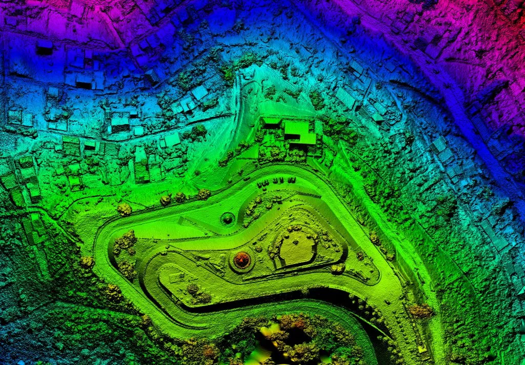
TerraOrbit Mapping Private Limited provides comprehensive end-to-end LiDAR solutions, including data capturing, processing, validation, and analytics. Our precise, actionable results empower industries with reliable insights for diverse applications, ensuring efficiency, accuracy, and innovation in geospatial data solutions.Our LiDAR services combine advanced technology, skilled expertise, and streamlined workflows to provide reliable, high-quality deliverables for your geospatial needs.
Using cutting-edge terrestrial, handheld, and UAV-mounted LiDAR systems, we collect high-resolution point cloud data tailored to project requirements. Our sensors ensure accurate coverage of terrain, structures, and other features with exceptional detail.
Our experienced team processes raw LiDAR data to create clean, classified point clouds. We use advanced software such as Cloud Compare, Qgis and Python Scripts to classify and extract features, ensuring data integrity and accuracy.
From elevation modelling to volume computations, we derive meaningful insights from LiDAR datasets. These include:
Grid Levels: Precise elevation grids for terrain modelling and engineering applications.
Contours : Detailed contour maps with customizable intervals for design and planning.
Cross-Sections and Profiles : Accurate representations of terrain and structures for analysis and construction.
Earthwork Calculations : Volumetric analysis for excavation, fill, and construction planning.
As-Built Documentation: High-accuracy as-built models for infrastructure and utility verification.
GIS and CAD services at TerraOrbit integrate advanced mapping technologies with cutting-edge design capabilities, offering unparalleled solutions for spatial analysis and visualization. By creating detailed maps and models, we empower industries such as utilities management, urban planning, and environmental monitoring. These services provide a comprehensive understanding of spatial data, enhancing efficiency and enabling informed decision-making. GIS and CAD ensure seamless integration of data and design, delivering actionable insights that are instrumental for successful planning and project execution.

Utilizing high-precision tools, we convert analog maps, survey plans, and raster images into accurate digital vector data.
Process: Geo-referencing, heads-up digitization, and quality checks using GIS software.
Deliverables: Clean and topologically correct vector datasets compatible with GIS and CAD systems.
Designing detailed thematic maps for specific applications, including land use, zoning, and utility management.
Process: Data analysis, symbology customization, and thematic layering to present actionable insights.
Deliverables: Custom thematic maps in digital and printable formats, suitable for reports and presentations.
Creating comprehensive geodatabases to store, query, and manage spatial and non-spatial data.
Process: Data modelling, database design, and implementation using Geodatabase, and Cloud Data Warehouses.
Deliverables: Structured spatial databases supporting advanced GIS queries and analysis.
Cadastral Mapping: High-accuracy boundary and property mapping for land ownership documentation.
Topographical Mapping: Detailed terrain representation for engineering and environmental applications.
Parcel Mapping : Comprehensive mapping of land parcels with associated ownership and usage data.
Utility Mapping: Precise mapping of utilities such as water, electricity, and telecommunication networks.
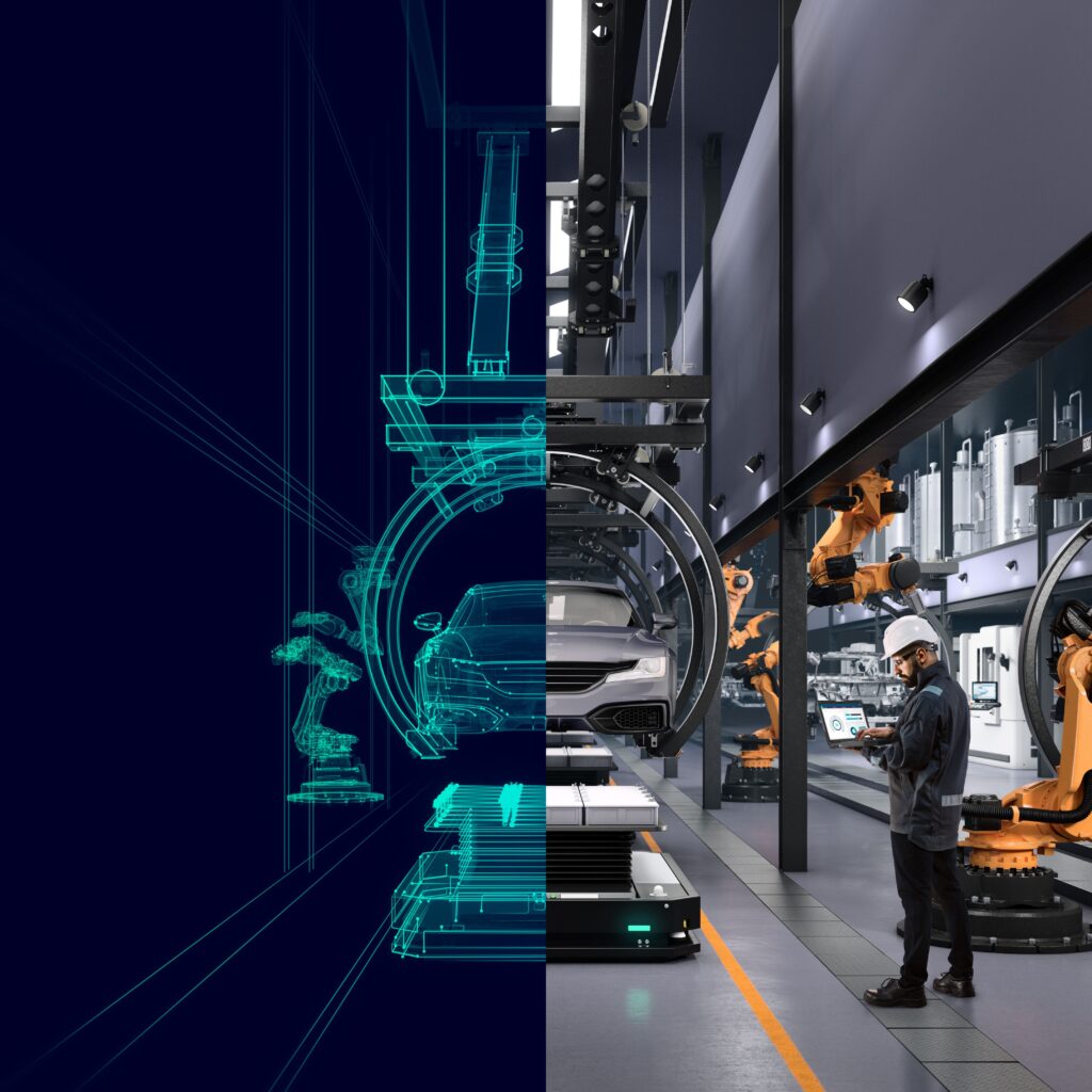
A Virtual 360° Tour is an immersive, interactive experience that allows users to explore a location digitally as if they were physically present. It uses 360-degree panoramic imagery or videos to create a detailed, navigable representation of a real-world environment.
1. Full Spherical View: Users can look in all directions (up, down, left, right) by dragging the view or using navigation controls.
2. Interactivity: Many virtual tours allow users to click on hotspots to move to different areas, view additional information, or access multimedia content (e.g., text, images, or videos).
3. Accessibility: These tours can be accessed on various devices, including smartphones, tablets, VR headsets, and computers.
4. Realism: Advanced tours use high-resolution images or videos, sometimes combined with 3D modelling, to deliver a lifelike experience.
5. Customization: Virtual tours can include maps, audio guides, embedded links, and other enhancements for a tailored experience.
Real Estate: Showcasing properties to potential buyers remotely.
Tourism: Promoting destinations like hotels, museums, or heritage sites.
Education: Virtual field trips to historical, cultural, or scientific locations.
Event Planning: Allowing clients to explore venues for weddings, conferences, or exhibitions.
Retail: Enabling customers to browse stores or showrooms online.
Our BIM services provide a comprehensive, data-driven approach to project delivery. With a focus on precise modeling and integration of various design disciplines (architectural, structural, MEPF, and infrastructure), we enable effective coordination, conflict resolution, and streamlined project workflows. Whether you need 3D modeling, scan-to-BIM, scan-to-CAD, or construction documentation, we leverage advanced technologies to enhance project accuracy, reduce costs, and accelerate timelines from design to construction.
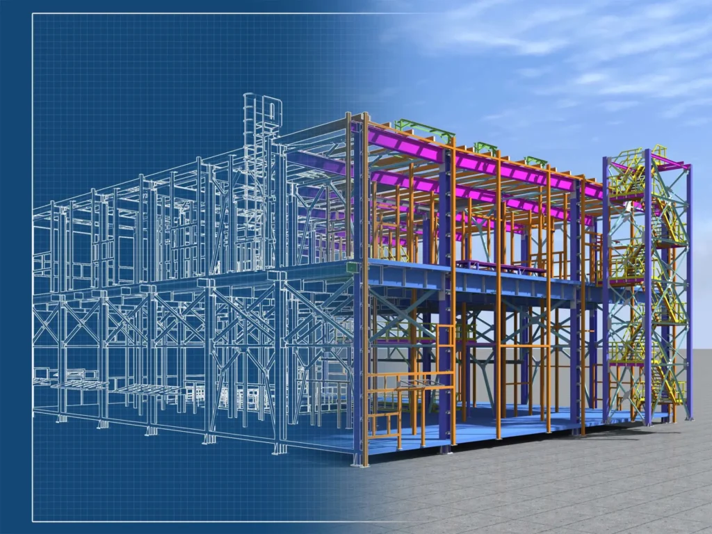
Architectural Modeling : Create detailed 3D models that accurately represent the architecture of buildings, enhancing design visualization, space planning, and overall project coordination.
Structural Modeling : Develop precise structural models for load analysis, material specifications, and structural integrity. These models help streamline construction and improve collaboration among stakeholders.
MEPF Modeling : Integrate Mechanical, Electrical, Plumbing, Fire (MEPF) systems into your BIM models, ensuring seamless coordination and early clash detection, improving system design and reducing errors during construction.
Roads: Model roadways with full geometric and cross-sectional accuracy to support design, construction, and maintenance phases. Our BIM process includes terrain analysis, drainage systems, and integration with other infrastructure elements.
Wet and Dry Utilities : Design and model utility networks (water, sewer, gas, electrical, and telecommunications) within the BIM environment. Our services ensure proper coordination between utilities and other infrastructure components, reducing conflicts during construction.
3D Scan to BIM : Utilize LiDAR scanning and point cloud data to create highly accurate as-built BIM models, improving renovation, refurbishment, and retrofitting workflows. This service ensures that existing conditions are accurately captured and integrated into the BIM environment.
Raster to Vector Conversion: Convert scanned or raster images into precise vector drawings, enabling smoother integration into CAD and BIM systems for further modeling and design processes.
Prepare Construction Shop Drawings: Generate detailed construction drawings directly from your BIM models, facilitating clear, actionable plans for contractors and fabricators. These drawings ensure that all stakeholders are aligned and that construction proceeds without delay.

Our inspection services leverage advanced geospatial technologies such as UAVs (drones), LiDAR, thermal imaging, 3D scanning, and DGPS to provide precise, data-driven insights for various industries. We specialize in non-invasive, high-accuracy inspections that enhance operational efficiency, safety, and decision-making.By incorporating cutting-edge geospatial technologies, we deliver reliable, accurate, and actionable insights for your inspection needs. Our services help you reduce downtime, enhance safety, and optimize maintenance, ensuring the long-term success of your assets and infrastructure.
High-Resolution Imaging : Capture detailed visual data for structures, plants, and assets, providing in-depth condition assessments.
Thermal Imaging : Detect heat anomalies like water leaks, electrical faults, or structural weaknesses without direct contact.
Access to Hard-to-Reach Areas : Quickly and safely inspect areas like tall buildings, wind turbines, and bridges, reducing the need for scaffolding or human entry.
Real-Time Data : Obtain live video feeds and real-time data, enabling immediate decision-making and remote monitoring.
High-Precision 3D Scanning: Create accurate 3D point clouds to capture detailed geometries of structures and terrain, ensuring a comprehensive analysis.
Structural Monitoring : Continuously monitor infrastructure for potential deformations, settlement, or alignment issues using precise LiDAR data.
Detailed Surface Models : Generate Digital Elevation Models (DEMs), Digital Surface Models (DSMs), and Digital Terrain Models (DTMs) for comprehensive surface analysis.
Asset Health Monitoring : Regular inspections using UAVs and LiDAR to detect wear, corrosion, or material degradation, enabling proactive maintenance and extending asset lifespan.
Water Leakage Detection : Identify moisture anomalies through thermal imaging, helping pinpoint areas of leakage in pipelines or buildings.
Environmental Impact Assessments: Use geospatial data to assess environmental impacts like soil erosion, water contamination, and vegetation loss.
Predictive Maintenance and Risk Assessment
Data-Driven Insights: Use historical inspection data and predictive analytics to forecast potential issues, helping reduce the likelihood of unexpected failures.
Risk Assessment: Assess risks to infrastructure based on environmental conditions, asset health, and historical data to prioritize maintenance and minimize disruptions.
Infrastructure Inspections : Bridges, tunnels, wind turbines, powerlines, sub-stations, dams, and roads.
Energy Sector : Solar plants, wind farms, oil & gas refineries, and power stations.
Building Inspections : Roofs, facades, boilers, and structural elements of commercial and industrial buildings.
Environmental Monitoring : Flood risk areas, wetlands, vegetation, and mining sites.
Utility Inspections: Water, gas, and electrical systems.
Construction and Structural Integrity: Monitoring construction sites to ensure compliance with design specifications and safety regulations.
Get in touch with TerraOrbit today to explore how our geospatial services can transform your projects with precision and innovation. Let’s shape the future with actionable insights!